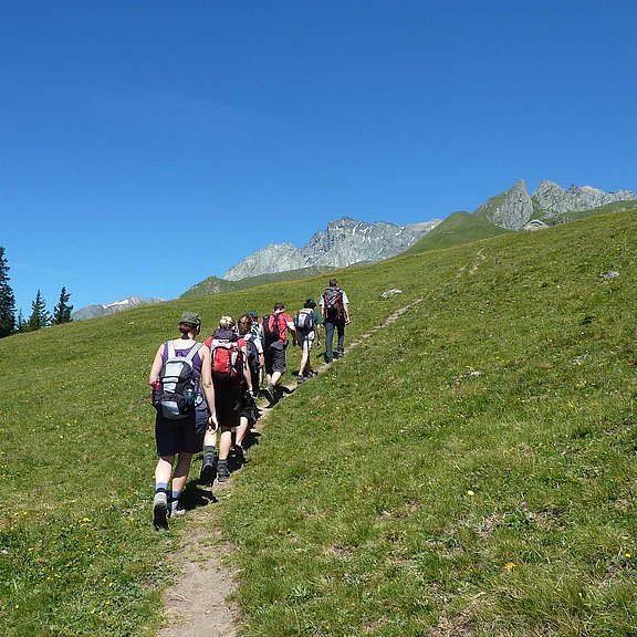
Hiking tips in East Tyrol
We present you some beautiful hiking highlights in East Tyrol!
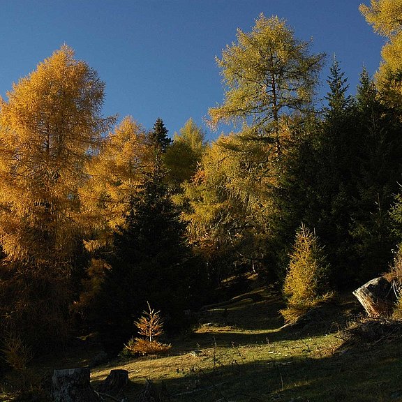
THEME PATH ZEDLACH PARADISE
The Zedlach Paradise theme trail leads through an enchanting larch forest. The oldest larches have an admirable age of 500 years and an enormous trunk circumference of up to seven meters. This makes them among the oldest larch stands in Tyrol. Through display boards, the forest habitat and the formation of the unique larches are explained in detail to the visitors. When the centuries-old larches turn golden yellow in autumn, it is at its most beautiful in the Zedlacher Paradies.
Starting point: Matrei-Zedlach parking lot Jösen
End point: Matrei-Zedlach parking lot Jösen
Difficulty: easy / hiking trail
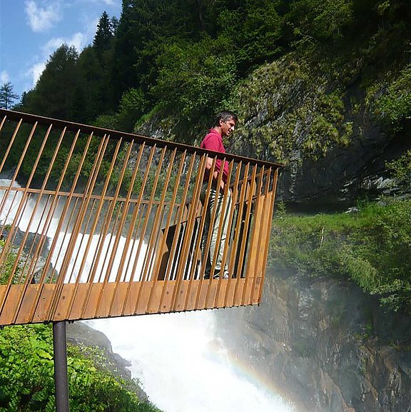
NATURE POWER TRAIL "UMBALFÄLLE"
The NaturKraftWeg Umbalfälle in the rear Virgen Valley presents the origin of a gigantic glacial stream and its landscape-shaping effect in an extraordinary way. Whether high above the gorge or up close to the water, display boards and viewing platforms make the incredible natural force of the water directly tangible. In 2014, the NaturKraftWeg Umbalfälle was awarded the Austrian Hiking Seal of Quality.
Starting point: Prägraten parking lot Ströden (toll)
End point: Umbalfälle
Difficulty: easy / hiking trail
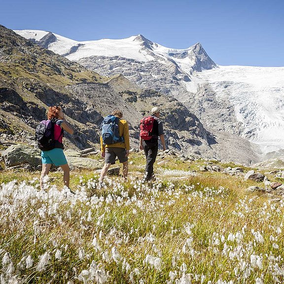
HIKE TO THE INNERGSCHLÖSS
A hike to the Innergschlöß offers an impressive view of the glacier world of the Venediger Group and the summit of the Großvenediger (3,667 m). You get to see up close how the forces of the glaciers once shaped the landscape. The hike from the Matreier Tauernhaus to the Venedigerhaus is easy along the alpine path even with a stroller.
Starting point: Matreier Tauernhaus
End point: Venedigerhaus Innergschlöß
Difficulty: easy / hike
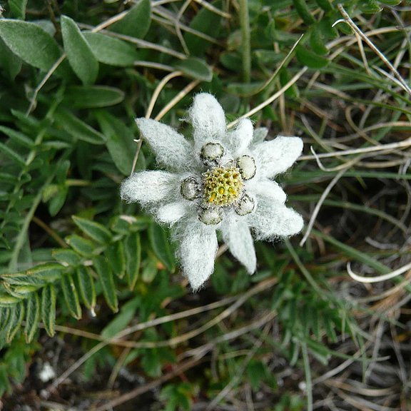
ACROSS THE EDELWEISS MEADOW TO THE STEINER ALPS
Besides the beautiful view of Matrei and the Lasörlinggruppe, there are also many colorful flowers and numerous insects to see. This hike allows you to view beautiful edelweiss, larch forests, alpine meadows and dwarf shrubs.
Starting point: Glanz parking lot
End point: Hoanzeralm
Difficulty: easy / hiking trail
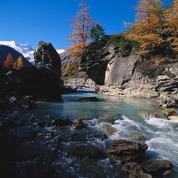
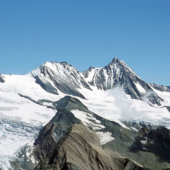
GLACIER TRAIL INNERGSCHLÖSS / SCHLATENKEES
The Innergschlöss Glacier Trail takes you directly into the core zone of the Hohe Tauern National Park. You get exciting insights into the landscape-forming power of the glaciers in the Alps. Likewise, due to the retreat of the glaciers, climate change can be perceived at first hand.
Starting point: Venedigerhaus Innergschlöss
End point: Schlatenkees
Difficulty: moderately difficult / Red mountain trail
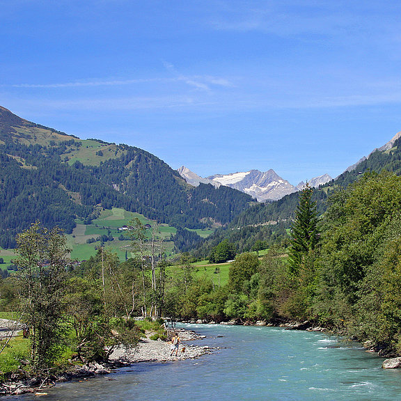
AUENWEG TO HINTERBICHL
The Auenweg offers a beautiful walk along the Isel to Hinterbichl. The Isel is the last free-flowing glacial river in the Eastern Alps.
Starting point: TVB information office Prägraten
End point: Hinterbichl bus stop
Difficulty: easy / hiking trail
EUROPEAN PANORAMA TRAIL
The Europapanoramaweg offers a breathtaking panorama of over sixty 3000m peaks! This trail, accessible by cable car, offers a magnificent family hike with indescribable views of the breathtaking mountains.
Starting point: Matreier Goldried cable cars
End point: Blauspitz mountain station
Difficulty: easy / hiking trail
MUHS-PANORAMAWEG
The Muhs-Panoramaweg offers a wonderful view of the three-thousand-meter peaks of the Venediger Group. If you want to overlook the Venediger Group from the south, you will find the ideal viewing balcony with double refreshment stop in the high trail between Berger-See-Hütte and Lasnitzenalm in East Tyrol.
Starting point: Parking lot sawmill
End point: parking lot sawmill
Difficulty: moderately difficult / Red mountain trail
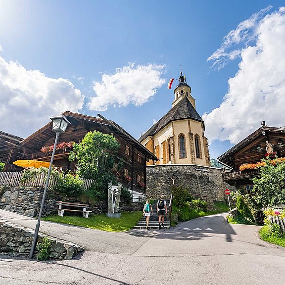
PRÄGRATEN - HIGH BANK - OBERMAUERN
On the old connecting path from Prägraten to Obermauern on a worthwhile visit to pilgrimage church "Maria Schnee". This church is considered one of the most beautiful sacred buildings in East Tyrol.
Starting point: TVB information office Prägraten
End point: Obermauern pilgrimage church "Maria Schnee
Difficulty: easy / hiking trail